A non-profit organization providing comprehensive information and insight on steelhead, salmon, trout, and the overall fishery along Minnesota's North Shore of Lake Superior - The Steelhead Highway.
Hers is a shot of D. Allen with a nice fall run North Shore Pink Salmon. This was caught mid-September and he went 22"! This is a biggie by Minnesota Standards.
Shore casting the North Shore of Lake Superior can at times appear to be a daunting task, it is, however, an enjoyable and very effective way to fish the big lake. River mouths Most of us have seen the numerous fishermen lining the banks near the French or Lester rivers. Why? Because these are consistently good places to fish. A beginning shore caster would be smart to start their quest fishing river mouths, particularly early in the season when steelhead, Kamloops and lakers can be found in abundance. The river plumes provide warm water and a steady flow of bugs which fish like. Due to the fairly shallow water found at most mouths, it’s best to fish them in low light. Target these areas early in the morning and late in the evening or on a dreary overcast day. You will be less noticeable to the fish and they will be less apt to spook. Seeing how there are over 25 potential stream/river mouths to fish it would be crazy to ignore these great areas. Fly and hardware...
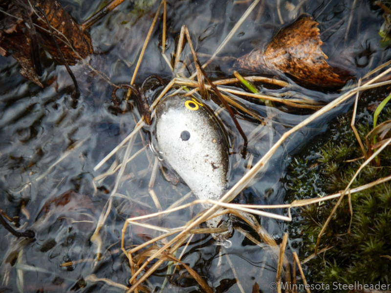
Years ago all an angler had was a paper regulation booklet and the word from fellow anglers and DNR officials stating that treble hooks are not allowed in our north shore tributaries below the posted boundaries. This should be enough, right? Today we still have those regulation booklets and honestly they have come a long way in clarifying the dos and don'ts regarding our north shore fishery. We also have dozens of signs along our rivers explaining the dos and don't as well as specifically stating the use of treble hooks. If that was not enough, anglers can simply search the internet. Heck, these days, you can search stream side right from your phone. In fact this post will be available streamside to anyone willing to take the time to search the web or scan the UR code from our report cards that went out this spring. Pictured above is a photo of a a crankbait that is in many o' bass anglers tackle arsenal. Heck, I have a few myself. T...
One of the most useful and productive fly patterns you can carry when you fish the runs for steelhead, kamloops and salmon are eggs. Any time free drifting eggs are in the stream is a good time to fish them and, they can be fished with any type of equipment from Fly to Spinning rods. A wise SE Wisconsin guide once told me, "Any pattern will catch fish, as long as it has an egg in it." As with all flies, you will go through A LOT of them. One option is to purchase them, but at a dollar a pop or more, making your own is a simple and inexpensive proposition. In a short amount of time and with just a few simple tools, you can crank out eggs by the hundreds at just pennies per piece. I’m going to assume that you know how to do some basic tying; but if you don’t, this is a good pattern to start learning with because it will teach you some of the basics: How to Start Your Thread , how to position materials, and the Whip Finish . On Sizing I use the metric standard because it is eas...


Comments
Way to go...
NMF